The most recent major geologic force that shaped Wyoming as we know it today were the Ice Ages. For the past 3 million years the earth’s climate has periodically cooled and gotten wetter allowing huge sheets of ice to form in the mountains. These sheets of ice became so thick they created glaciers, sheets of ice often miles thick, which then began to flow down towards the valleys. These massive walls of ice acted as huge bulldozers carving canyons, and shaping the jagged peaks and cirques of Wyoming’s mountain ranges. There were at least four major glaciations and several smaller ones. The most recent glacial event ended about 10,000 years ago and evidence of it is all around Sinks Canyon. Huge granite boulders carried from high in the mountains and deposited in the canyon are evidence of the power of the ice.
-
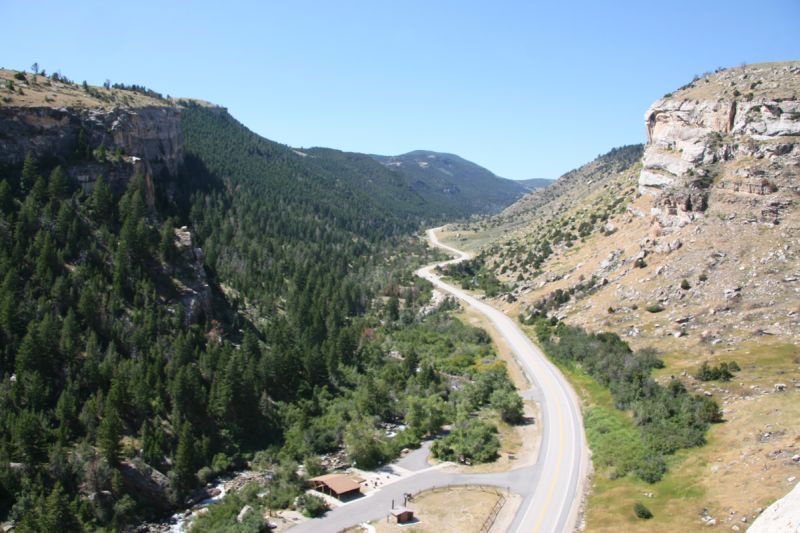
This view up canyon shows the distinct “U” shape of a glacially carved canyon. Canyons carved by rivers have a “V’ profile.
-
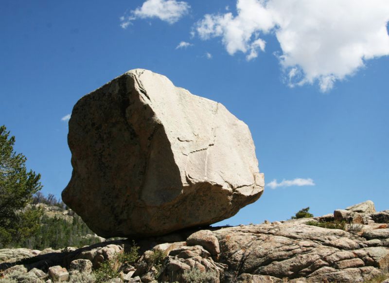
Enough ice can lift and carry rocks that weigh tons. Glaciers moving out of the mountains tore off huge pieces of granite and carried them for miles. When the glaciers melted, these rocks were often deposited in unusal places and positions. Perched boulders are rocks sitting on surfaces with no visible way of having gotten there.
-
Glacial Moraines are visible in Sinks Canyon. These are long piles of rock deposited as the glaciers melted. A glacier acts like a giant conveyer belt. Material scrapped from the floor and walls of the canyon by ice is constantly carried to the glaciers sides and end.
-
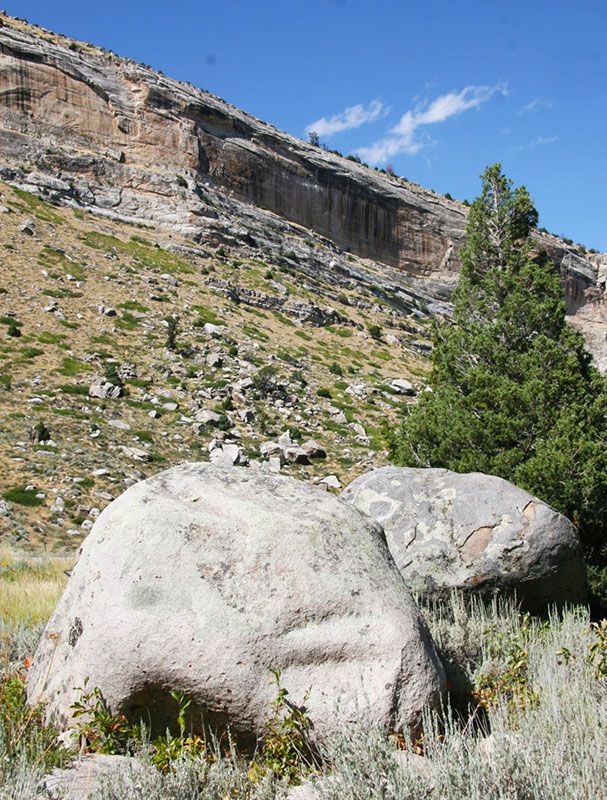
Glacial erratics are granite boulders carried from higher in the mountains by the ice and deposited on a surface of different material than the erratic.
-
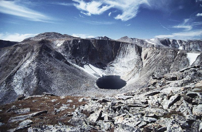
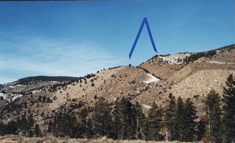
The effects of glacial erosion are spectacular in the mountains. The jagged, sharp peaks and cliffs in the Wind River Range show how much rock was quarried by the ice. At the head of glaciated valleys in the mountains you often find deep, steep-walled bowls called cirques. The glacier originated here are and as it moved down it gouged out granite.
-
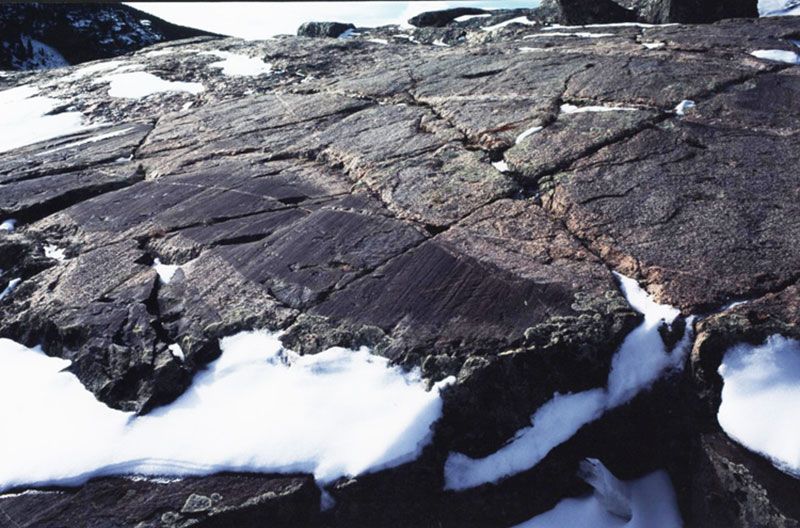
Granite polished and scarred by sheets of glacial ice grinding across it.
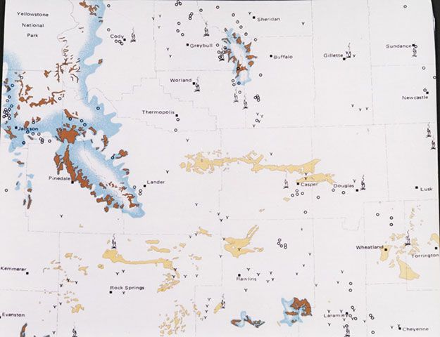
This maps shows the extent of the glacial ice at the height of the most recent ice age. The Wind River Mountains and most of the Northwest corner of the state were covered by thousands of feet of ice. The yellow represents sand dunes (many of which still exist today) created by the wind blowing fine sand from glacial outwashes.